No1 : World’s best Product Based company in India
GPS India Networks Pvt Ltd.GPS India Networks Pvt Ltd.GPS India Networks Pvt Ltd.
Working Days (Mon- Sat)
10:00 AM to 6:30 PM
Shipping & mailing Services
New Delhi – 110024

Garmin GPSMAP 65S

FIND YOUR WAY IN THIS BIG, WIDE WORLD

Garmin GPSMAP® 64s

Explore more with this rugged handheld that offers multiple frequencies for our most accurate position to date, a 2.6” color display and preloaded maps.

Don’t miss a detail with this large, sunlight-readable color display.
Lead the way in challenging locations with multi-band technology and expanded GNSS satellite support.
Plot your next move with built-in navigation sensors.
Organize your adventure from anywhere with the Garmin Explore website and app1.
Travel with up to 16 hours of battery life in GPS mode.

Product description

Feature Specs In The Box

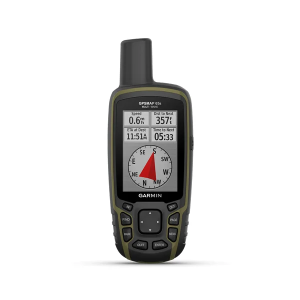
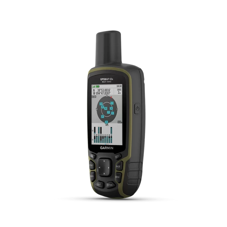
EXPANDED GNSS SUPPORT
Multi-band technology and expanded GNSS support (GPS, GLONASS, Galileo, QZSS and IRNSS) provide optimal accuracy in steep country, urban canyons and forests with dense trees.

ABC SENSORS
Navigate every trail with ABC sensors, including an altimeter for elevation data, barometer to monitor weather and 3-axis electronic compass.

SMART NOTIFICATIONS
Receive emails, texts and alerts right on your handheld when paired with your compatible device.

GARMIN EXPLORE APP
Plan, review and sync waypoints, routes and tracks by using the Garmin Explore app1 and website. You can even review completed activities while still in the field.

GEOCACHING
Get paperless geocaches by uploading GPX files straight to your device. View key information such as location, terrain and hints from Geocaching.com.
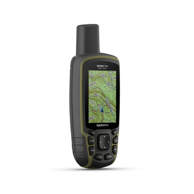
MICROSD SLOT
Using your compatible device and microSD memory card, conveniently download TOPO 24K maps and hit the trail, or access HuntView Plus maps to see public land types and boundaries as well as private landowner names and boundaries.

General

PHYSICAL DIMENSIONS2.4" x 6.3" x 1.4" (6.1 x 16.0 x 3.6 cm)
DISPLAY SIZE1.43" x 2.15" (3.6 x 5.5 cm); 2.6" diag (6.6 cm)
DISPLAY RESOLUTION160 x 240 pixels
DISPLAY TYPEtransflective, 65K color TFT
WEIGHT7.7 oz (217 g) with batteries
BATTERY TYPE2 AA batteries (not included); NiMH or Lithium recommended
BATTERY LIFE16 hours
WATER RATINGIPX7
HIGH-SENSITIVITY RECEIVER 
INTERFACEhigh speed mini USB and NMEA 0183 compatible
MEMORY/HISTORY16 GB (user space varies based on included mapping)

Maps & Memory

PRELOADED MAPSbasemap only
ABILITY TO ADD MAPS 
BASEMAP 
AUTOMATIC ROUTING (TURN BY TURN ROUTING ON ROADS) 
MAP SEGMENTS3000
BIRDSEYE250 BirdsEye Imagery files
EXTERNAL MEMORY STORAGE(32 GB max microSD card)
WAYPOINTS/FAVORITES/LOCATIONS5000
TRACKS200
TRACK LOG10000 points, 200 saved tracks
ROUTES200, 250 points per route; 50 points auto routing

Sensors

GPS 
NavIC (IRNSS) 
GLONASS 
GALILEO 
BAROMETRIC ALTIMETER 
COMPASS(tilt-compensated 3-axis)
GPS COMPASS (WHILE MOVING) 

Daily Smart Features

VIRB REMOTE 
PAIRS WITH GARMIN CONNECT MOBILE 
SMART NOTIFICATIONS ON HANDHELD 

Outdoor Recreation

POINT-TO-POINT NAVIGATION 
COMPATIBLE WITH BASECAMP 
AREA CALCULATION 
HUNT/FISH CALENDAR 
SUN AND MOON INFORMATION 
GEOCACHING-FRIENDLY(Paperless)
CUSTOM MAPS COMPATIBLE(500 custom map tiles)
PICTURE VIEWER 

Outdoor Applications

COMPATIBLE WITH GARMIN EXPLORE APP 
GARMIN EXPLORE WEBSITE COMPATIBLE 

Connections

WIRELESS CONNECTIVITY(BLUETOOTH®, ANT+®)
  • GPSMAP 65s
  • USB cable
  • Carabiner clip
  • Documentation

Contact

Quick Enquiry Now!