No1 : World’s best Product Based company in India
GPS India Networks Pvt Ltd.GPS India Networks Pvt Ltd.GPS India Networks Pvt Ltd.
Working Days (Mon- Sat)
10:00 AM to 6:30 PM
Shipping & mailing Services
New Delhi – 110024

Garmin GPSMAP® 66s

Garmin GPSMAP® 64

Premium GPS Handheld with BirdsEye Satellite Imagery Subscription

GPSMAP® 66s Multisatellite Handheld with Sensors
Large, 3” sunlight-readable color display for easy viewing
Multiple Global Navigation Satellite Systems (GNSS) support to track your travels in more challenging environments than GPS alone plus three-axis compass and barometric altimeter
Access to BirdsEye Satellite Imagery with direct-to-device downloads and no annual subscription

Product description

Overview Specs In The Box
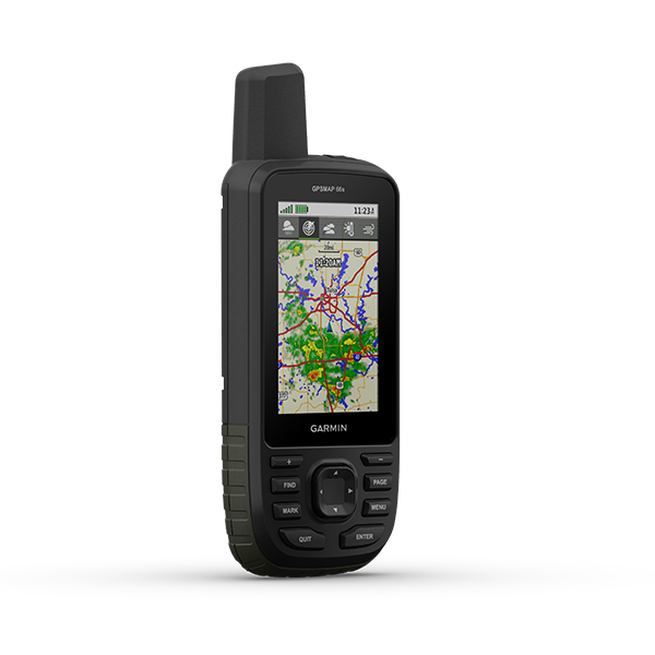
  • Expanded wireless connectivity supports Active Weather for up-to-date forecasts and animated weather radar and Geocaching Live for mobile syncing and updates
  • Compatible with Garmin Explore website and app to help you manage tracks, routes and waypoints and review statistics from the field
  • Up to 16 hours of battery life in GPS mode; 1 week in expedition mode lets you explore longer than ever before on a single set of AA batteries

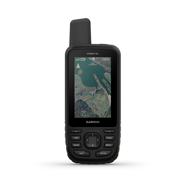
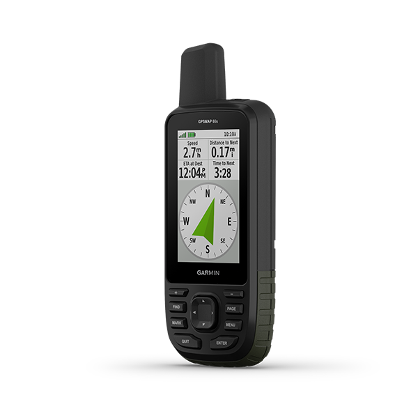
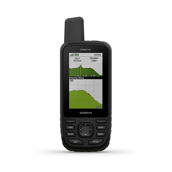
Navigate your next outdoor adventure with the GPSMAP 66s. Whether you’re hiking, hunting, climbing, geocaching, kayaking or mountain biking, you can explore more with this premium, rugged handheld with a 3” color display. It features access to BirdsEye Satellite Imagery with direct-to-device downloads to help you find your way. And it offers multi-GNSS support as well as wireless connectivity for Active Weather, direct downloads and Garmin Explore compatibility.

General

PHYSICAL DIMENSIONS2.5" x 6.4" x 1.4" (6.2 x 16.3 x 3.5 cm)
DISPLAY SIZE1.5"W x 2.5"H (3.8 x 6.3 cm); 3" diag (7.6 cm)
DISPLAY RESOLUTION240 x 400 pixels
DISPLAY TYPEtransflective color TFT
WEIGHT

8.1 oz (230 g) with batteries

BATTERY2 AA batteries (not included); NiMH or Lithium recommended
WATER RATINGIPX7
HIGH-SENSITIVITY RECEIVER 
MEMORY/HISTORY16 GB

Maps & Memory

PRELOADED MAPS

basemap only

ABILITY TO ADD MAPS 
BASEMAP 
AUTOMATIC ROUTING (TURN BY TURN ROUTING ON ROADS)(with optional mapping for detailed roads)
EXTERNAL MEMORY STORAGEmicroSD™ card (not included)
WAYPOINTS/FAVORITES/LOCATIONS10000
TRACK LOG20000 points, 250 saved gpx tracks, 300 saved fit activities
ROUTES250

Sensors

BAROMETRIC ALTIMETER 
COMPASS(tilt-compensated 3-axis)

Outdoor Recreation Features

AREA CALCULATION 
HUNT/FISH CALENDAR 
SUN AND MOON INFORMATION 
GEOCACHING-FRIENDLY(Paperless)
CUSTOM MAPS COMPATIBLE 
PICTURE VIEWER 

Additional

ADDITIONAL
  • Garmin Explore compatible: yes
  • Garmin Connect IQ compatible: yes
  • Wireless compatible: yes (Wi-Fi, Bluetooth and ANT+)
  • Map segments: 15,000
  • Active weather: yes
  • Smart Notifications: yes
  • Live Tracking: yes (with Garmin Connect Mobile)
  • BirdsEye direct to device: yes (no annual subscription required)
  • MIL STD 810G ruggedness for thermal, shock and water performance
  • RINEX Logging: yes
  • GPSMAP 66s
  • Access to Birdseye Satellite Imagery
  • USB cable
  • Carabiner clip
  • Documentation

Contact

Quick Enquiry Now!